
AKM Geotechnical specialises in providing expert advice and solutions to help you overcome the geological challenges associated with your project. Our team of highly experienced and qualified engineers and geologists is dedicated to providing comprehensive and reliable services that meet your specific needs.
What is Engineering Geology?
Engineering geology services are a range of services that involve the application of geological knowledge and techniques to the planning, design, construction, and maintenance of engineering projects. These services are essential for ensuring that construction projects are safe, sustainable, and economically viable.
Engineering geology services typically include site investigations, geological mapping, slope stability analysis, rock mechanics testing, and geohazard assessment. At AKM Geotechnical, we offer a wide range of engineering geology services, including site investigation, geological mapping, slope stability analysis, rock mechanics testing, and geohazard assessment. Our services are designed to provide you with the information you need to make informed decisions about your project and to ensure that your project is completed safely, on time, and within budget.
Our Services
Our expert team of geologists are proficient in accumulating data from fields for interpretation and translating this information into engineering data to identify areas of significant physical constraints that will adversely affect the design, construction, and maintenance of any intended engineering projects. Engineering geology has its applications in Civil Engineering, Urban planning and Environmental studies. It is used in designing solid waste management systems for special purpose mapping such as for making reserve estimates. Engineering geologists’ work is essential in civil, mining and petroleum projects.
Our range of services include:
● Geological Mapping
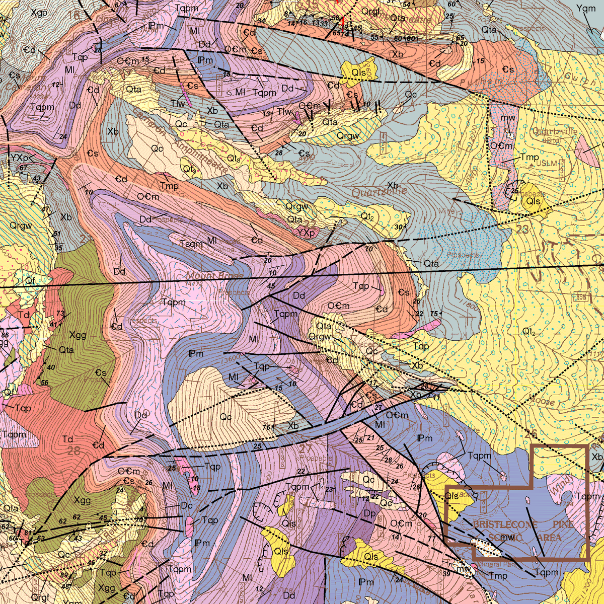
Our team of Geologists are skilled in field mapping no matter how difficult the terrain is they find out the best way to cover and complete the task effectively saving cost and time for our partners. Geological maps are used to investigate geologic hazards, mineral resources, groundwater aquifers, and just plain science.
Our team of experts uses a variety of techniques, including aerial photography, satellite imagery, and field observations, to create detailed maps that show the site’s geological features, such as faults, folds, and rock formations. This information is used to assess the potential risks associated with the site and to design appropriate mitigation measures.
● Surface and subsurface 3D modelling

Creating a 3D geological map from field and subsurface data is a typical task in Geological studies for the evaluation of mineral resources or geological hazards. We have expertise from working in the field to collect data and to interpreting, reporting and designing to build full 3D Geological maps.
● GIS & Remote Sensing
Our specialists have attention to detail and focus to interpret satellite remote sensing imagery for large areas. Geospatial technology has taken precedence over conventional techniques in terms of accuracy and time management. GIS & RS technology has its application in mapping subtle indications of mineral alteration, geological structures and identifying lithology which leads to successfully evaluating large areas of interest for mineral potential, focus field evaluations, and ultimately a higher probability for exploration.
● Mine Engineering
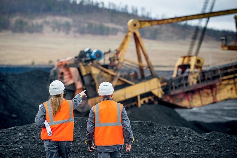
Successful mining project requires both technical expertise and experience. Through our team of specialists we are able to provide mine design, beginning from field exploration, reservoir estimation and mapping, giving our clients productive, cost-effective and environmentally acceptable solutions.
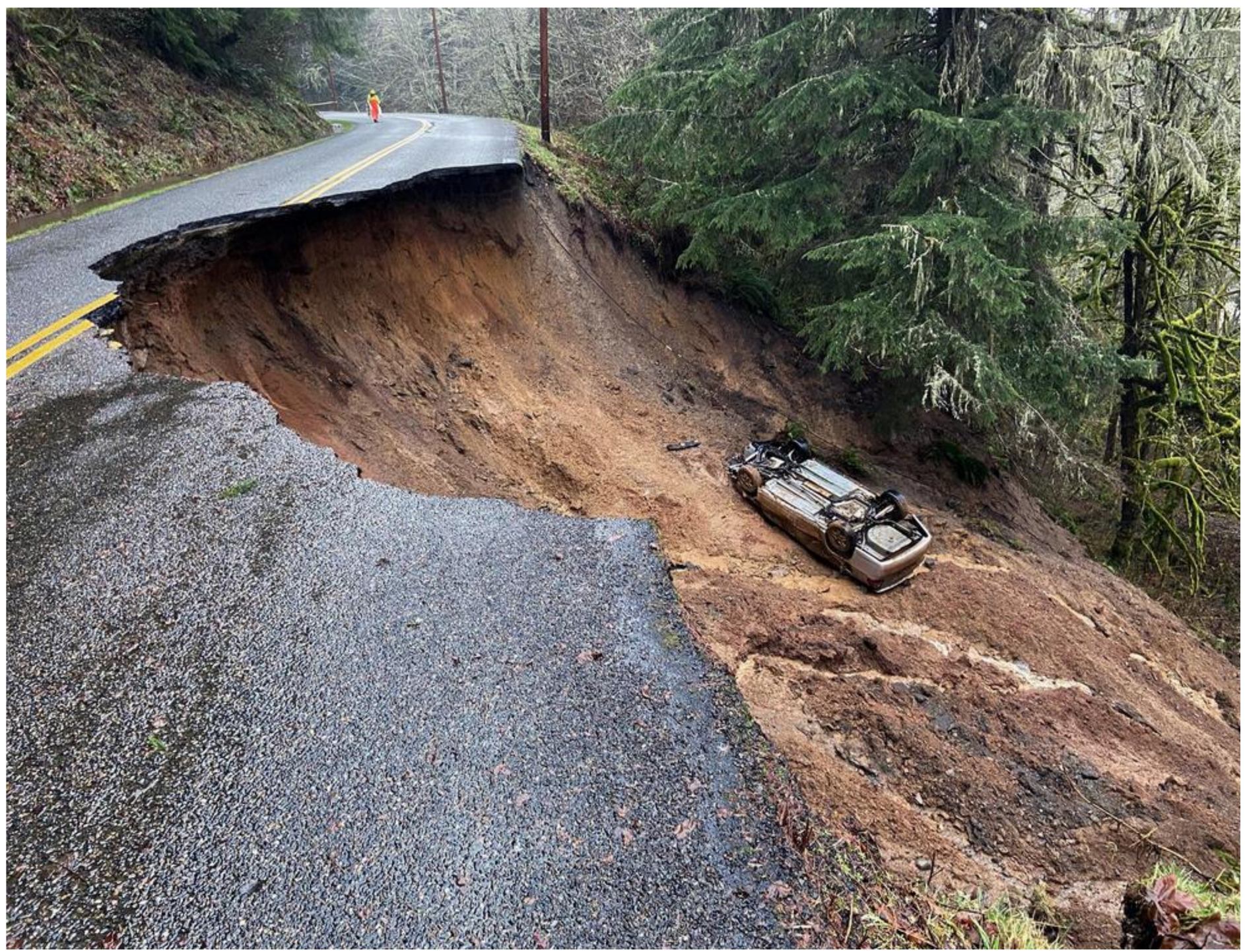
● Landslide and Slope Stability
Our specialists have attention to detail and focus to interpret satellite remote sensing imagery for large areas. Geospatial technology has taken precedence over conventional techniques in terms of accuracy and time management. GIS & RS technology has its application in mapping subtle indications of mineral alteration, geological structures and identifying lithology which leads to successfully evaluating large areas of interest for mineral potential, focus field evaluations, and ultimately a higher probability for exploration.
Our team uses advanced software and modeling techniques to assess the stability of slopes and to predict the likelihood of failure. This information is used to design appropriate stabilization measures, such as retaining walls, anchors, and drainage systems, to prevent slope failure and ensure the safety of workers and the public.
● Groundwater Studies
Our qualified team of hydrogeologists have experience and skill to provide appropriate, practical and cost-effective solutions to all your issues. Groundwater studies has its practical application in many fields from design of water-wells, irrigation schemes, investigating the quality of water, designing dewatering schemes and dealing with groundwater studies for mining and other purposes. Our team of qualified engineers are there to help you and give you the best solution to your every problem.
● Electrical Resistivity Survey
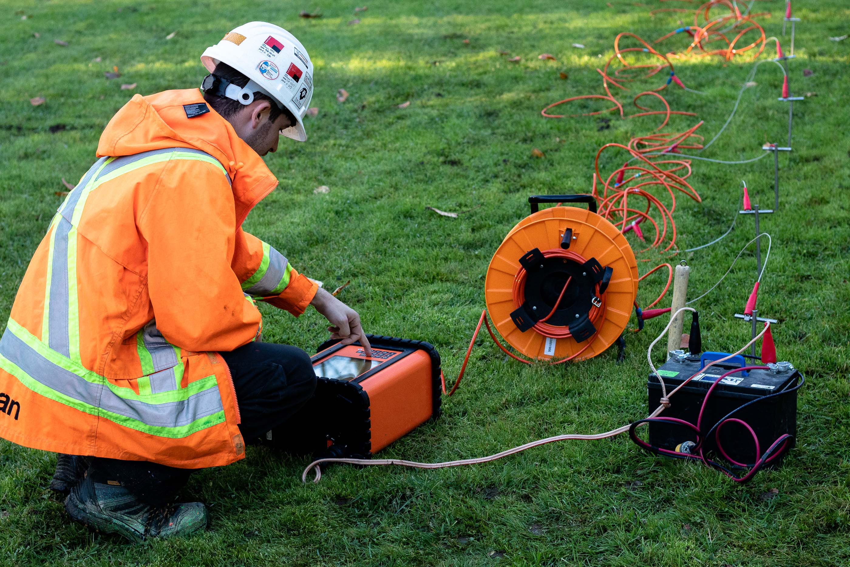
Through our qualified engineers and equipment we are able to deliver quality service in a timely manner saving you both cost and time. We have solutions to all your problems regarding subsurface identification of quality and quantity of water and mineral resources. Our team is able to perform accurate testing procedures in the field to interpret field results and design reports.
● Seismic Refraction Survey
Non-Destructive testing such as seismic refraction survey (SRS) requires a great deal of expertise and skill to be able to collect data from the field, then interpreting and designing a final report. Seismic refraction survey gives a velocity model in which seismic energy is made to travel through rock or soil which helps in identification of lithology, degree of fracturing, water content and weathering. This method has its application in Geological studies and Geotechnical Engineering.
● Site Investigation
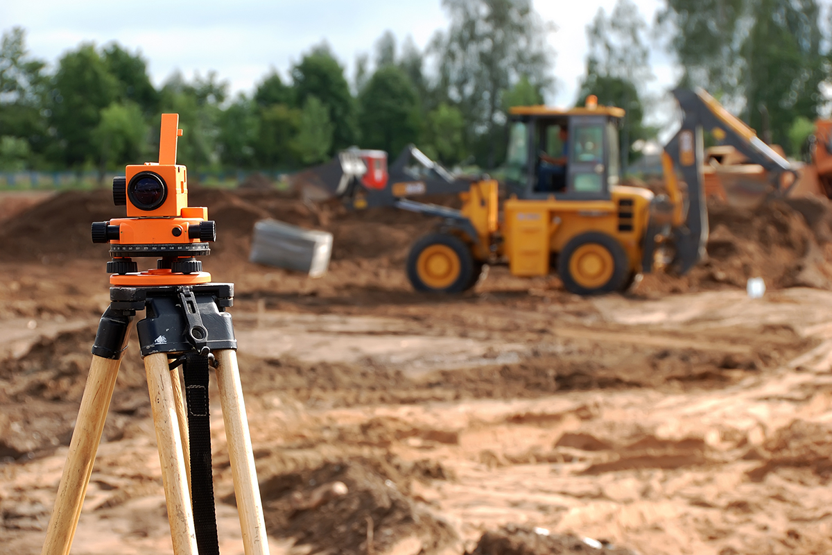
It is a critical part of any construction project, as it provides essential information about the site’s geology, soil properties, and groundwater conditions. Our team of experts uses state-of-the-art equipment and techniques to collect and analyze data, including soil and rock samples, groundwater levels, and geological maps. We also perform laboratory testing to determine the properties of the materials at the site.
● Rock Mechanics Testing
This is another important service we provide. Our team of experts uses advanced laboratory testing techniques to determine the physical properties of rocks, including strength, elasticity, and durability. This information is used to design structures that can withstand the stresses and strains associated with the geological conditions at the site.
● Geohazard Assessment
It involves identifying potential hazards, such as landslides, rockfalls, and sinkholes, that can pose a risk to people and infrastructure. Our team of experts uses a variety of techniques, including field observations and laboratory testing, to identify potential hazards and to design appropriate mitigation measures.
At AKM Geotechnical, we are committed to providing you with the highest quality engineering geology services. Our team of experts has the knowledge, experience, and resources to help you overcome the geological challenges associated with your project. Contact us today to learn more about how we can help you achieve your project goals.